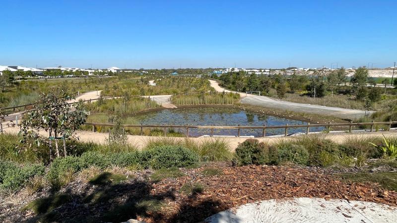
Water sensitive urban design (WSUD)
Site planning
Best practice guidance for site planning
Decision framework
There are a range of Australian Standards/best practice guidelines, relating to this category. Key documents are referenced throughout and in the LIM WSUD - Design (design guideline hierarchy) LIM WSUD - Standards.
See the following for further information:
- LIM WSUD – Appendix A: Sunshine Coast Council – strategic documents and guidelines.
- LIM WSUD – Appendix B: External documents – industry guidelines, tools, best practice.

Site decisions
All decisions, including the location of the embellishment and related infrastructure, must be made in conjunction with council (determined by site location), including officers from such areas as:
- Council (Parks and Gardens)
- Council (Environmental Operations)
- Council (Transport Network Management)
- Council (Transport Infrastructure)
- Council (Planning)
- Council (Transport Network Operations)
- Council (Environment and Sustainability Policy)
Users
Consult with council stakeholders, neighbouring properties and identified park users in the planning stage of a project.
Site conditions
Consider the physical characteristics of a site and requirements of the activities to be conducted:
- location of utilities.
Co-location of facilities
Facilities, including parking and pathways, are often already established and need to be considered in the overall park design.
Safety
- To create a safe work environment during landscape management, comply with the MUTCD and the Workplace Health and Safety Act 2011.
- Where landscaping is provided adjacent to/ adjoining drop-offs, slopes over 15 degrees, water, roads, electricity and other critical risks, a risk assessment must be undertaken. The risk assessment must be carried out by a suitably qualified professional, and barriers or other treatments must be provided to mitigate critical risks.
- Safety clearances must be met.
- Adopt principles of Crime Prevention Through Environmental Design (CPTED) Guidelines of Queensland. Locate WSUD to allow users to feel safe, and to provide an opportunity for casual surveillance.
Potential site conflicts
Locate WSUD systems away from:
- High use bikeways, busy roads, and steep slopes, to avoid accidents.
- Open spaces with other users, to avoid interference.
- Free flowing pedestrian or cyclist traffic to minimise interruption.
- Hazards such as sewers and stormwater drains, underground services, power poles and overhead power lines.
- Play spaces - A risk assessment must be conducted to minimise potential risks. Water bodies are not preferred near all abilities play spaces (AAPS).
Consider environment and maintenance issues
When developing a WSUD system, examine ongoing maintenance considerations together with environmental concerns.
Key location considerations
- New stormwater infrastructure should NOT be installed within existing open space, unless an existing stormwater function has been identified
- Stormwater quality infrastructure such GPT's, streetscape raingardens, gully pit (including baskets), stormwatered street trees, etc., should be located within road reserve, rather than in open space.
- WSUD assets should be outside of natural waterways and wetlands and their riparian buffer areas (consistent with Desired Standards of Service for waterways and wetlands in Part C of the ELS).
Planning for sustainability
Refer Design principles – Sustainability for guidance.
Planning for future works
- Co-locate embellishments requiring similar services e.g. water, to reduce infrastructure, where possible.
- Where underground utilities are installed, set brass markers to concrete slab edges to indicate the location.
- Consider installation of additional conduits under concrete slabs for future provision, where utilities (e.g. electrical, water) and irrigation systems are planned. Ensure additional conduit is capped to prevent ingress of water and debris.
- Consider climate change impacts on the embellishment location and construction 1.
- In coastal areas, or near waterways, design should consider rise in sea level predictions, storm tide, salt inundation and severe storm events.
- Positioning should also consider flooding, seasonal/ephemeral water bodies and water table changes.
- Near bushland areas, design should consider the occurrence of bushfires.
Source 1: Sunshine Coast Environment and Liveability Strategy 2017.
Water sensitive urban design (WSUD)
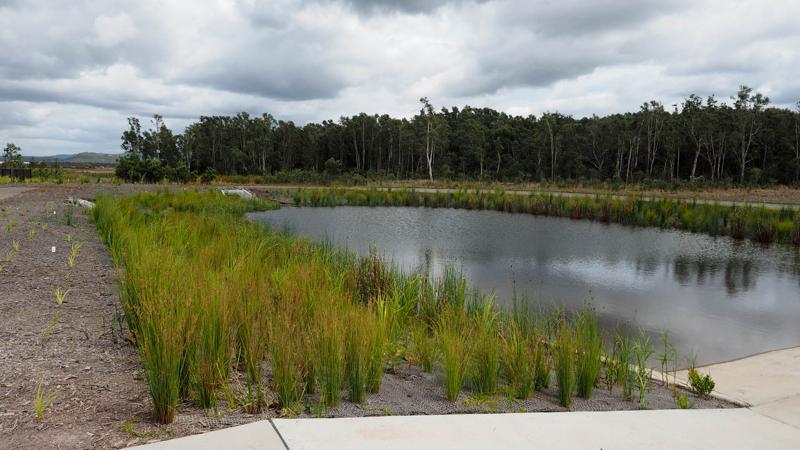
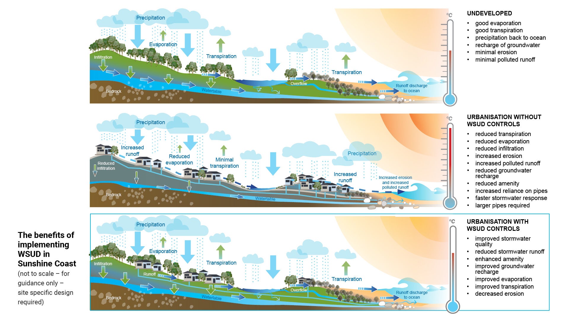
Water Sensitive Urban Design (WSUD) is a holistic approach to urban planning and design that integrates land and water planning and management into urban design. WSUD is based on the premise that urban development and redevelopment must address the sustainability of water. It is an important part of water cycle management, aiming to protect aquatic ecosystem health and to minimise negative impacts on the natural hydrological cycle.
WSUD planning integrates the urban water cycle – including stormwater, groundwater and wastewater management – into urban design.
The design and planning processes for Water Sensitive Urban Design require an assessment of the site (e.g. physical form and hydrological features) to be undertaken, prior to engineering design calculations.
It is required that appropriately qualified professionals (such as a Registered Professional Engineer of Queensland (RPEQ) qualified in the relevant field) design, review and approve all proposed designs. This ensures their inclusion and embellishment is appropriately adapted to local conditions and data.
Treatment systems dedicated to Council as public assets must be designed to:
- minimise maintenance
- minimise renewal and adaptation costs
- minimise the requirement for specialised equipment, materials or maintenance techniques.
- preserve and support connected natural waterways and wetlands and their buffers.
- minimise impact to open space.
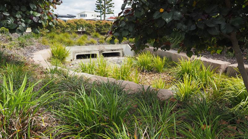
These devices may be located/designed to treat/manage stormwater "at source" or "end of line".
- At source: the first opportunity to manage or treat stormwater adjacent to its discharge point. These devices are smaller in size as they incrementally treat the upstream catchment.
- End of line: the last opportunity to manage or treat stormwater prior to its discharge to the downstream receiving environment. These devices may be quite large if they are treating the entire catchment.
Benefits
Water Sensitive Urban Design (WSUD) provides a holistic, comprehensive, water centric approach to the planning and design of urban development. WSUD can assist in enhancing the health of aquatic and terrestrial ecosystems, and reducing negative impacts on natural water cycles.
WSUD recognises the value of stormwater and waterways as both an asset and a resource. This is achieved by integrating the management of stormwater, potable water supply and wastewater at the development scale.
The main objectives of WSUD are to:
- preserve current natural features and processes
- sustain hydrology of catchments
- protect and enhance surface and ground water quality
- reduce demands on reticulated water supply systems
- decrease discharge of wastewater into the environment
- incorporate water into the natural landscape to complement the amenity of the built and natural environment.
The integration of WSUD principles into greenfield and infill developments as well as urban redevelopment programs is required in order to meet local, state and federal legislative requirements.
See Figure 1: The benefits of implementing WSUD in Sunshine Coast Region.
Social and community outcomes
WSUD plays a key role in the preservation and enrichment of the Sunshine Coast region, benefiting the wider community.
There are several key indicators that benchmark the success of implementing WSUD into the development of our region. These include:
- integrated stormwater treatment into landscape design
- improved flood management and mitigation
- preserved and enhanced natural environment
- improved water quantity
- improved sustainability of region
- enhanced visual amenity
- increased recreational opportunities
- preserved ecological habitat and biodiversity
- reduced potable water consumption
- opportunities for education, interpretation and exploration.
Impacts and sustainability
As population growth and development continues, the need for effective WSUD will play an integral role.
The positive effects of WSUD include:
- decreased erosion of beaches and waterways
- reduced levels of sediment in our waterways
- reduced pollutant loads
- reduced deposits on aquifer beds
- increased uptake of runoff and rainfall for re-use
- reduced impervious surfaces
- increased open space integration
- minimised urban heat island effect
- improved climate resilience opportunities
- increased groundwater recharge benefits
- improved health of waterways and waterway corridors
- enhance wildlife corridor opportunities
- reduced life cycle costing
- reduced maintenance costs.
Figure 1: The benefits of implementing WSUD in Sunshine Coast Region
Flooding and stormwater management
One of the benefits of adopting WSUD is that it reduces the potential for increased runoff volume, thus reducing downstream flows and flooding.
Stormwater
"The term ‘stormwater’ is used to describe that part of rainfall that directly runs off the land surface.
- Stormwater run-off may either travel down the drainage catchment as ‘surface flow’ or within conduits as ‘piped flow’.
- The term ‘stormwater’ also includes any contaminants (pollutants) collected by the water during its travels.
- Stormwater that soaks into the ground is often referred to as ‘groundwater’" (Source: A Public Guide to Managing Stormwater Drainage on Residential Properties (V2. 2020) by Catchments and Creeks).
Some of the impacts made by stormwater runoff include:
- waterways have reduced flows most of the time, and higher flows for a few hours after it rains.
- more frequent and intense flows, which can cause major damage to the natural and built environment such as increase erosion.
- altering the habitats and affecting the breeding habits of near shore, marine and aquatic animals such as; dolphins, dugongs, platypus, fish.
- depositing a layer of sediment on top of filter feeders (such as oyster beds), smothering them.
When installing WSUDs in commercial zones, high density residential areas and streetscape projects, considerations must be taken to ensure the treatment is designed to manage all inputs into the system, such as roof runoff from stormwater. The WSUD treatment must be designed to adequately cater for the combined capacity of the downpipes from roof catchments, with road/pathway runoff. The design of the WSUD must also ensure the treatment does not create flooding down the line.
Flooding
The insurance industry uses the following standard definition of flooding "the covering of normally dry land by water that has escaped or been released from the normal confines of: any lake, or any river, creek or other natural watercourse, whether or not altered or modified; or any reservoir, canal, or dam" .(Source: Insurance Council of Australia).
To assist with community safety and asset protection, rainfall and flood events are defined according to characteristics such as rainfall intensity and tail water conditions etc. These definitions are provided as a statistic to give a sense of frequency with which the event may occur. Smaller events occur frequently, while larger events occur infrequently, but are more damaging to assets and require greater financial assistance for the community to recover.
The following outlines standard industry accepted design flood terminology.
Impact of climate change on rainfall
As a result of climate change it is expected that there will be more intense storms and prolonged dry periods. As a result of the increase in rainfall intensity, it is expected that flooding will be more severe (Source: Insurance Council of Australia).
Australian Rainfall and Runoff (ARR) probability terminology
Source: Climate Impact and Adaptation Series by USQ
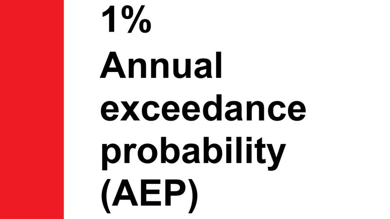
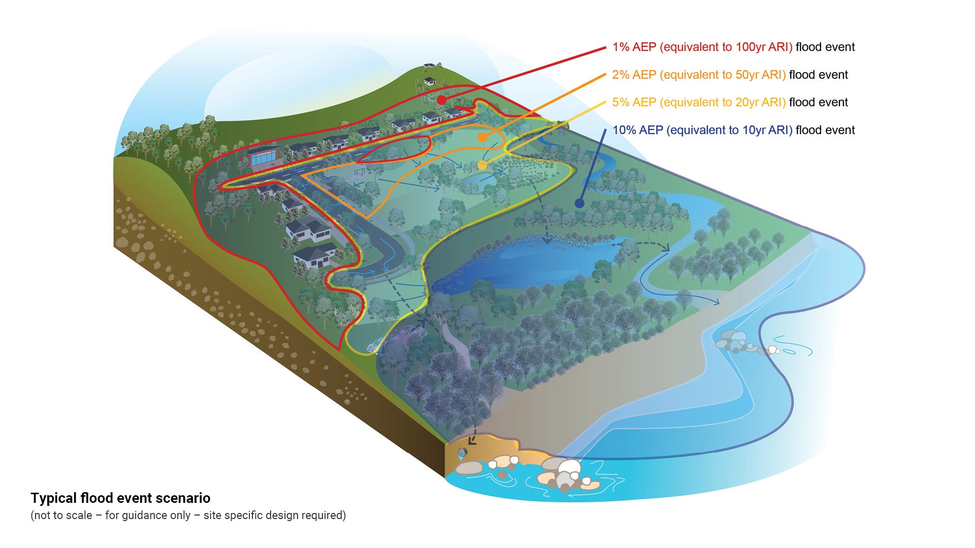
1% Annual exceedance probability (AEP): A flood event that has a 1.0% chance of occurring in any given year. Equivalent to 100 year Average Recurrence Interval (ARI). Residential houses are typically constructed with floor levels above this flood level (with freeboard). Roads are typically constructed to be trafficable during the 1% AEP flood event.
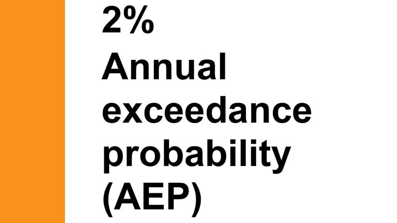
2% Annual exceedance probability (AEP): A flood event that has a 2.0% chance of being exceeded in any one year. Equivalent to 50 year ARI. Park facilities such as playgrounds and picnic facilities are typically constructed above this level.
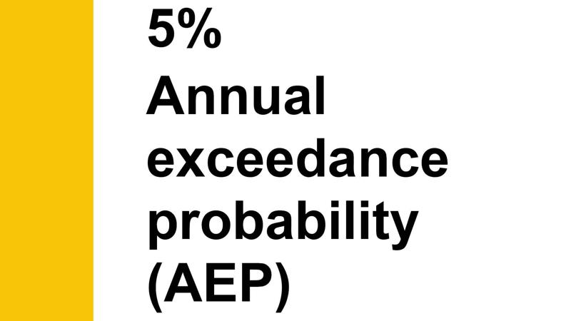
5% Annual exceedance probability (AEP): A flood event that has a 5.0% chance of being exceeded in any one year. Equivalent to 20 year ARI. Parks are typically constructed to be above this level.
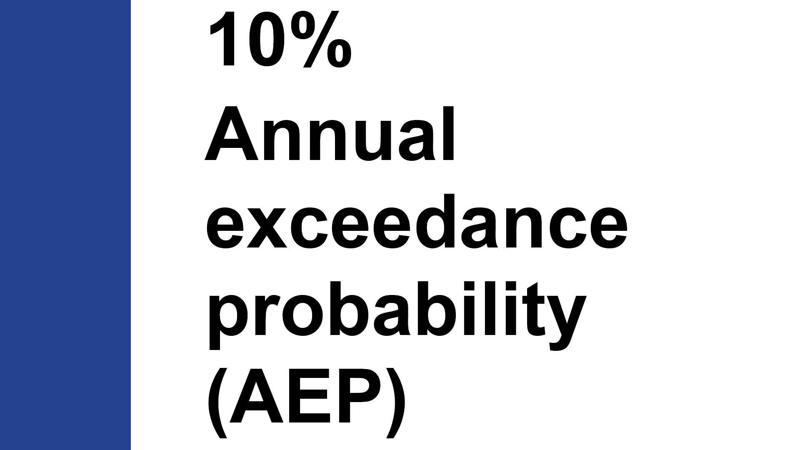
10% Annual exceedance probability (AEP): A flood that has a 10% chance of being exceeded in any one year. Equivalent to 10 year ARI.
Engage a suitably qualified Registered Professional Engineer in Queensland (RPEQ) to undertake appropriate hydrologic and hydraulic assessment.
See the following:
- Figure 2: Typical flood event scenario
- Figure 25: Example flood immunity for a typical park.
Figure 2: Typical flood event scenario
This component is currently in development